SLHS: Union Street


Disclaimer
Whilst some care has been taken to check externally linked websites no responsibility is offered nor implied for the suitability, legality or reliability of content therein.
Statements are made here to the best of our knowledge. However no statement here should be regarded as irrefutable fact. Please contact us if you consider otherwise.
The Days When Union Street Didn’t Exist
When Stratford was laid out Henley Street and Bridge Street were the eastern extent of habitation and Guild Street had been known as Gild Pitts* (see the map on the Master Page and here). It was literally the lowest ground, apart from land next to the river which it flowed into, and a pit where everyone threw their rubbish. Whilst it’s shown green on the map it certainly wasn’t that colour.
From Bridge Street, going North-west, there was a slight fork right, past High Street and into Henley Street. Union Street did not exist, as indicated by Bridge Street’s Consecutive House Numbering, which is why it is not shown on the map on the Master Page.
Further Information..
-
None yet..
● These items have aspects that uniquely contribute to national or world history.

To return to Master page click on ‘Streets’ above.
-
● Full
-
● Partial
-
● None
-
Theatres ●


Clean Up
When the brewery started operating in the 1840s it logically discharged its waste into the top end of Guild Pitts (North-west of this map). In it’s slow way down to the river in the summer the smell could be foul.
Meanwhile access to the coach park, at the rear of John Payton’s White Lion pub further North had to cross the pitts. This was very soft ground and in the end the Flower family, who owned the brewery, were asked to make a considerable contribution towards making this whole swathe (dark green) sanitary.
After the arrival of the canal c1820 we know that John Payton purchased land to the North of the pitts. He started to develop the area and named the streets after himself ie Payton Street and John Street.
However until the beginning of the 1830s the only route to the pitts, from Bridge Street or Henley Street going North, was between the houses down a tiny alley which still exists (shown dotted). John Payton wasn’t happy about this either.
Creation Of Union Street
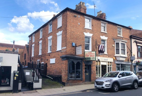
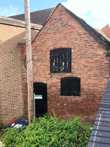
In 1833 the gardens of the houses at the top right of Bridge Street were replaced by a cul-de-sac leading half way down the hill (shown bright yellow). Near the top, on the East side (lower side as shown), three groups of houses were built between 1833-9. They went as far as a storage warehouse at the end of Gloucester Court which still exists (see below right).
In 1847 the cul-de-sac was pushed further down to the newly sanitised area now known as Guild Street (this is shown dash-hatched). This was called Union Street as it joined John’s properties to the town. It was not particularly developed until a huge headquarters was built by Ashwins.

Key
Road extent from 1833. Completed 1847.


Gloucester Court May 2024


(There are many links on this map)

Last update: 31/10/2024
Created: 04/05/2024